Back ريتشلاند (واشنطن) Arabic ريتشلاند ARZ ریچلند، واشینقتون AZB Ричланд Bulgarian Richland (Washington) Catalan Ричланд (Вашингтон) CE Richland (lungsod sa Tinipong Bansa, Washington) CEB Richland, Washington Welsh Richland DAG Richland (Washington) German
This article needs additional citations for verification. (February 2024) |
Richland, Washington | |
|---|---|
| City of Richland | |
 View over downtown Richland in 2018 | |
| Nickname(s): The Windy City, City Of the Bombers, Atomic City[1] | |
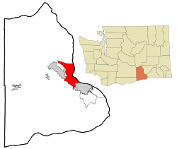
 Location of Richland, Washington | |
| Coordinates: 46°16′47″N 119°16′53″W / 46.27972°N 119.28139°W | |
| Country | United States |
| State | Washington |
| County | Benton |
| Government | |
| • Type | Council–manager government |
| • Mayor | Terry Christensen |
| • Mayor Pro Tem | Theresa Richardson |
| Area | |
| • City | 42.62 sq mi (110.38 km2) |
| • Land | 39.22 sq mi (101.59 km2) |
| • Water | 3.39 sq mi (8.79 km2) |
| Elevation | 384 ft (117 m) |
| Population (2020) | |
| • City | 60,560 |
| • Rank | US: 667th WA: 22nd |
| • Density | 1,345.5/sq mi (519.5/km2) |
| • Urban | 232,954 (US: 171st) |
| • Metro | 303,501 (US: 164th) |
| • CSA | 357,146 (US: 103rd) |
| • Tri-Cities | 215,024 |
| Time zone | UTC−8 (Pacific (PST)) |
| • Summer (DST) | UTC−7 (PDT) |
| ZIP codes | 99352, 99353, 99354 |
| Area code | 509 |
| FIPS code | 53-58235 |
| GNIS feature ID | 1513395[3] |
| Website | Ci.Richland.WA.US |
Richland (/ˈrɪtʃlənd/) is a city in Benton County, Washington, United States. It is located in southeastern Washington at the confluence of the Yakima and the Columbia Rivers. As of the 2020 census, the city's population was 60,560.[4] Along with the nearby cities of Pasco and Kennewick, Richland is one of the Tri-Cities, and is home to the Hanford nuclear site.
- ^ "Kiwanis Club of Atomic City, Richland, Washington". Archived from the original on November 27, 2020. Retrieved January 7, 2017.
- ^ "2019 U.S. Gazetteer Files". United States Census Bureau. Retrieved August 7, 2020.
- ^ "US Board on Geographic Names". United States Geological Survey. October 25, 2007. Retrieved January 31, 2008.
- ^ "QuickFacts Richland City, Washington".
© MMXXIII Rich X Search. We shall prevail. All rights reserved. Rich X Search
